

Why outline the area at all
A contractor cannot price pavement from a sentence like "the back lot needs work." The first thing every quote depends on is how many square feet and which part of the lot, and most property owners and managers do not know either. Until now that meant a phone call, a site visit just to measure, or a quote built on a guess that came back as a wide range.
The outline replaces that first measuring step. You tap the corners of the area on a satellite photo of your address, and the form works out the square footage and keeps the drawing with your request. Contractors see exactly which part of the property you mean, and they can start from a real number. You can mark more than one area and label each one, so a full replacement and a few patches in the same lot are not mixed together.
It is optional. If you would rather not draw, skip the map: the street address, photos and notes still tell us what we need, and we measure from the address.
Before you start
- The street address of the project. The exact address, not just the city: it is what the map and the measuring start from.
- A rough idea of the work. Paving or overlay, repair or patching, sealcoating, striping, concrete, drainage, or "not sure" are all valid answers.
- A few photos from your phone. The whole area from one corner, the worst spots up close, the entrance, and anywhere water collects.
- About ten minutes. The outline takes a minute or two once the map is open.
The steps, one at a time
Step 1: Open the form and choose how you want to proceed
Start at the free quote request. The first choice is whether you want to be matched with contractors, or matched and called first so we can write a scope of work.
The call is optional and works best for larger or more complicated projects. A scope of work is a written description of what will be done, so every contractor prices the same job. Choosing the call makes a phone number required, so we can reach you.
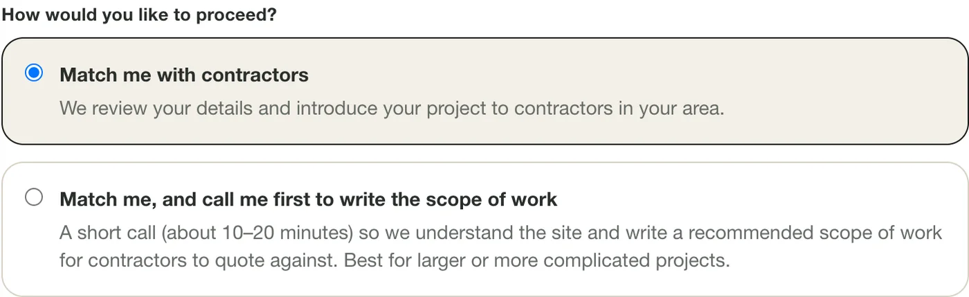
Choose matching only, or matching plus a scoping call. Tips
- Not sure? Choose the first option. You can always talk it through later.
Step 2: Enter the property and the exact street address
Pick the property type and what you need, then enter the street address of the project, with the city, state and ZIP. The address is required, and the exact street address matters: the map finds your property from it, and we look the site up from it too.
Add the approximate size and your timeline. Rough answers are fine. If you have several properties, enter the first one and list the rest in the notes at the bottom of the form.
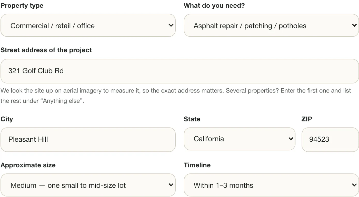
The street address is what the map and our measuring start from. Tips
- Use the address of the pavement, not your mailing address, if they differ.
Step 3: Describe the pavement (optional)
Next comes About the pavement. Answer what you can: the approximate area in square feet, the existing asphalt thickness if you know it, whether trucks and equipment can reach the work, what drives on it, and what you see (cracking, potholes, standing water, crumbling edges).
None of these are required. They help contractors send firm numbers instead of ranges. Questions that do not apply to the work you chose are hidden, so a striping request is not asked about asphalt thickness.
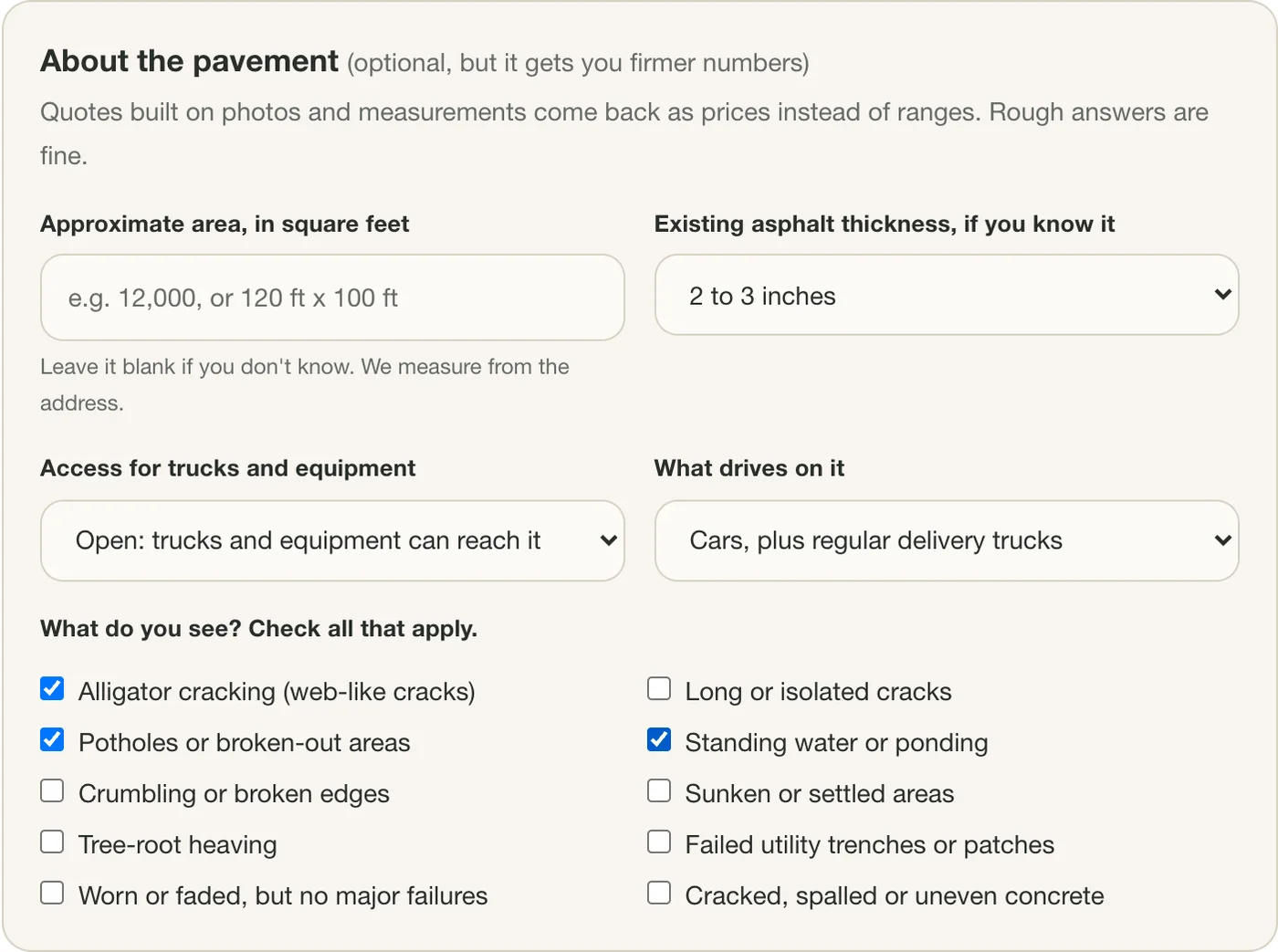
Describe the condition. Every question here is optional. Tips
- "I don't know" is a real answer for thickness and traffic.
- Leave the area blank if you do not know it. The outline in the next step works it out.
Step 4: Open the satellite map
Scroll to Outline the area, just below the pavement questions, and press Show my property on a map. The map opens as a satellite photo centered on your address, usually within a few seconds.
If it opens on the wrong building, correct the address fields above and press Look the address up again. That starts the drawing over, because an outline drawn for one address is not the outline for another.
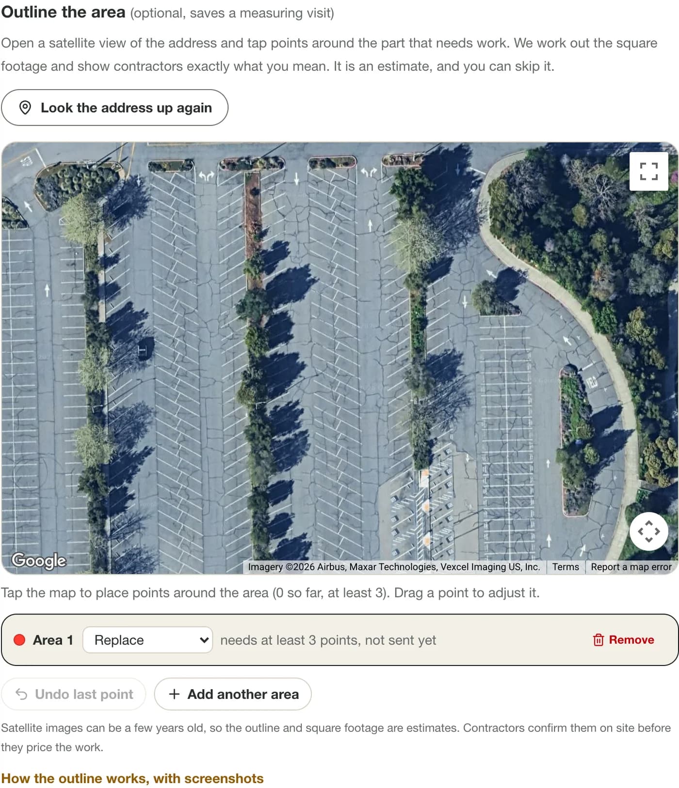
The satellite map opens on your address. Tips
- The map opens zoomed in close on purpose. Use the map's zoom controls, or hold Ctrl (Command on a Mac) and scroll, to zoom.
- To move the map, drag it. On a phone, use two fingers.
Step 5: Tap points around the area that needs work
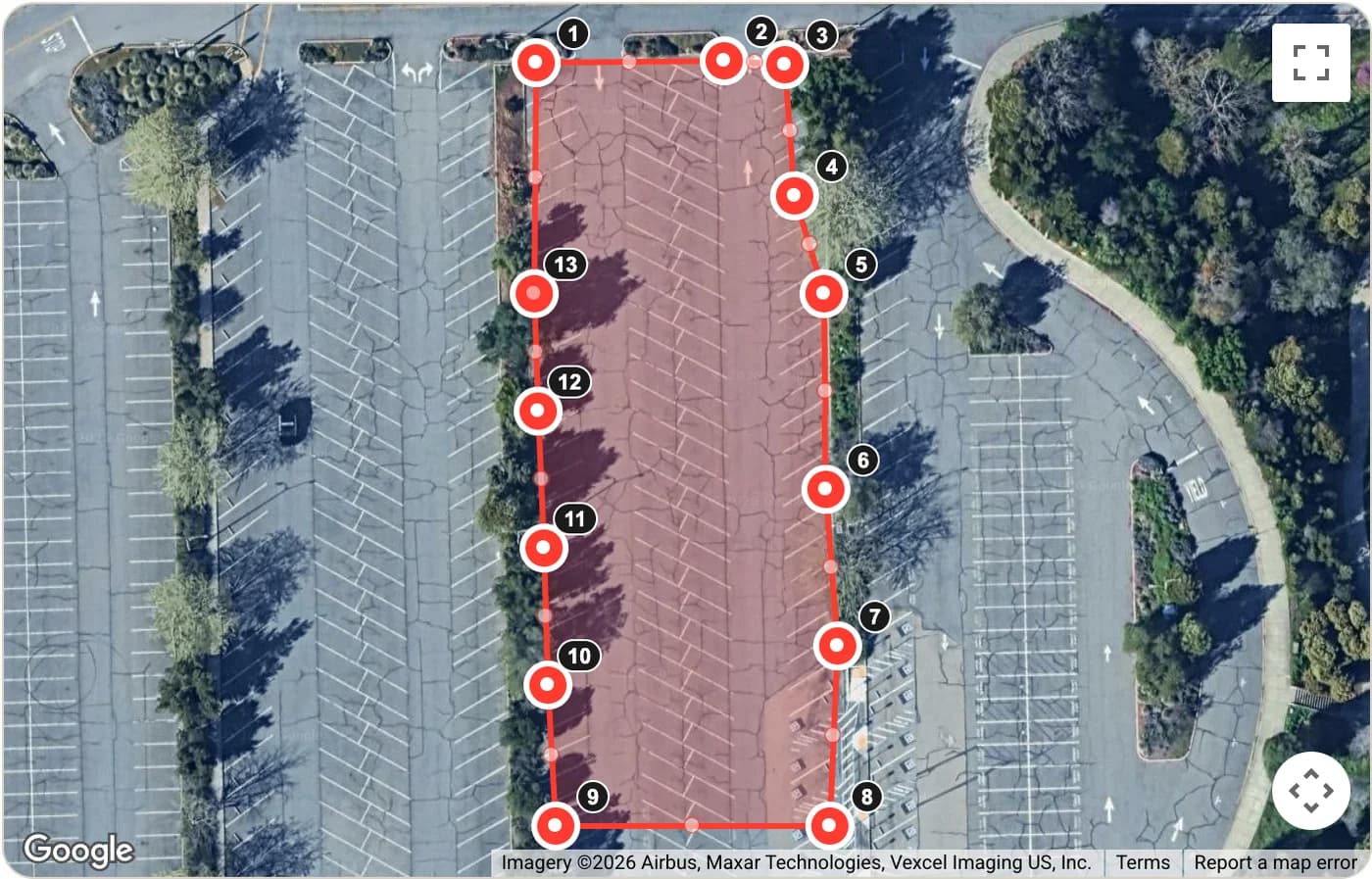
Tap or click at each corner of the area, going around it in order. Every point appears as a numbered dot, and once there are three points the area fills in with a semi-transparent shading and a border, so you can see exactly what you have marked.
Below the map you will see about N sq ft for that area, and a running total. It updates every time you add or move a point.
To fix a mistake, press Undo last point, or drag any dot to where it belongs. The small handles halfway along an edge add a new corner when you drag them.
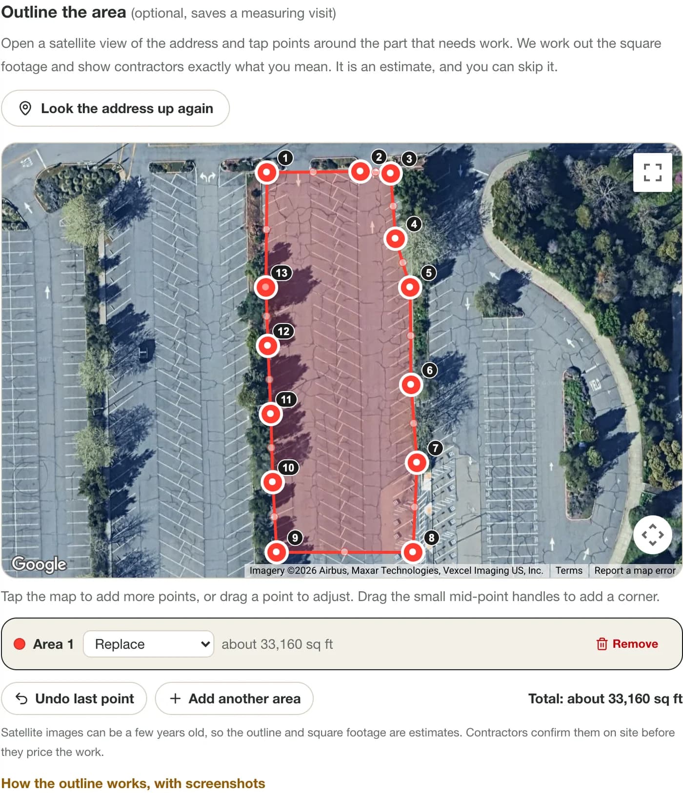
Tap the corners. The area is shaded and measured as you go. Tips
- Outline only the part that needs work, unless the whole lot does.
- Put each point on a corner, not in the middle of an edge. A few extra points around a curve are fine.
- Zoom in before you tap near a curb or a building. A closer map is a more accurate number.
Step 6: Add more areas and say what each one is
Press Add another area to mark a separate part of the property, up to five. Each area has its own type: Replace, Repair or patch, or Other work. The color of the shading and the dots follows the type, so a full replacement and a patch repair are easy to tell apart.
The total at the bottom adds every area together. Use Remove on an area you no longer want.
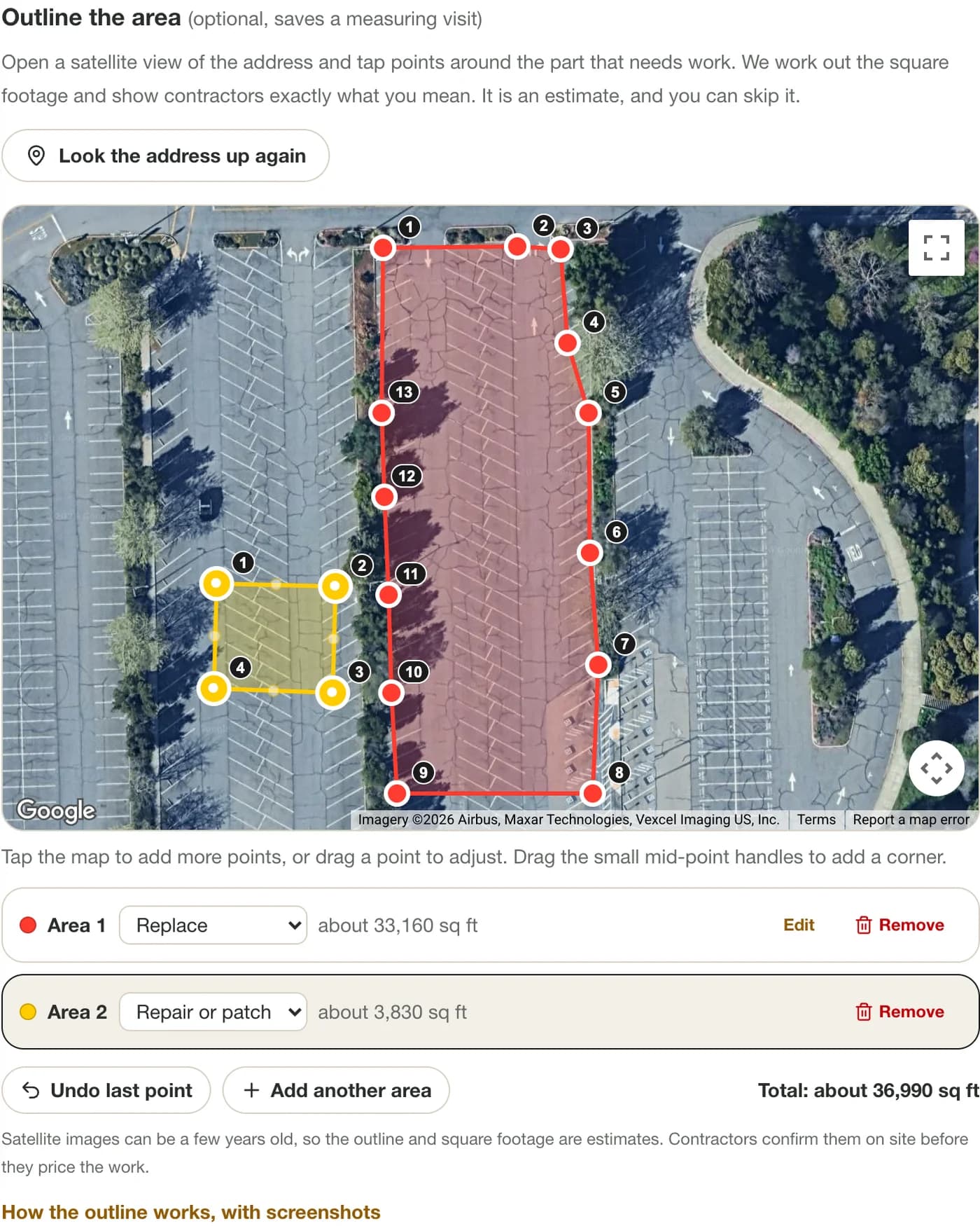
Label each area. The colors follow the type of work. Tips
- A parking lot with one failed corner and the rest in fair shape is two areas, not one: the failed corner as Replace, the worn rest as Repair.
Step 7: Add photos
Add up to ten photos. They go to private storage as soon as you choose them, and each shows a thumbnail with its size once it has been added. The photos you remove are not kept with your request.
The ones contractors ask for most: the whole area from one corner, a close-up of each bad spot with a tape measure or a shoe in the frame for scale, the entrance or gate, and anywhere water collects. Use the notes box to say what each photo shows or how big it is.
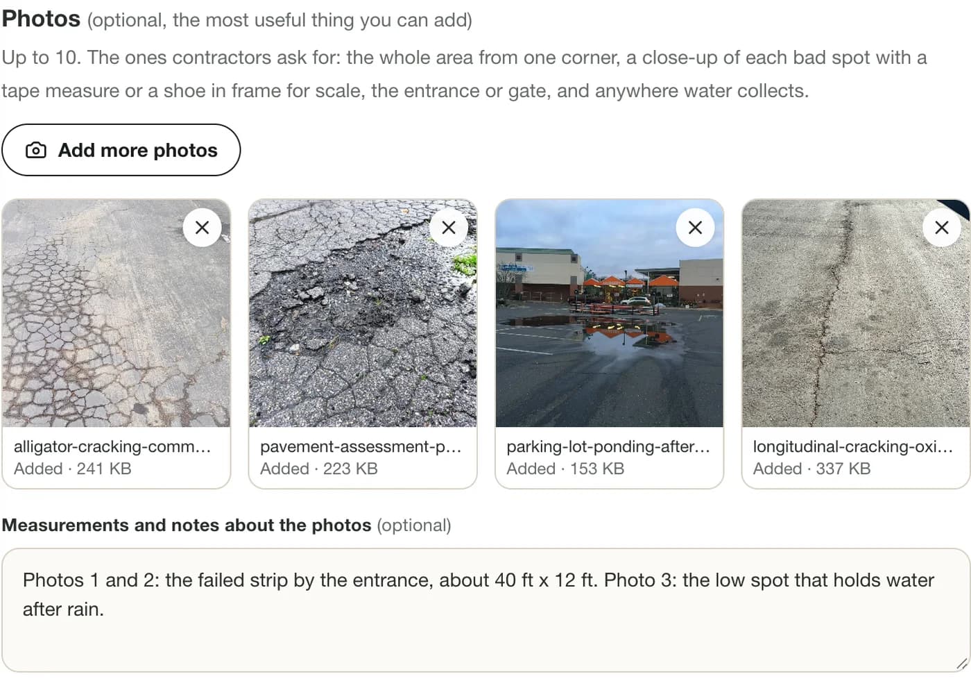
Photos and a note about what they show. Tips
- JPG, PNG, WebP and iPhone HEIC photos all work, up to 15 MB each.
- Photos taken at midday show cracks less clearly than early or late light.
Step 8: Send the request
Add your name and email (and a phone number if you chose the call) and press Request free quotes. The page scrolls to a green Request received box so you know it went through.
We read every request, and we will email you within one to two business days. If we cannot find suitable contractors for your location, we will tell you plainly instead of padding the list.
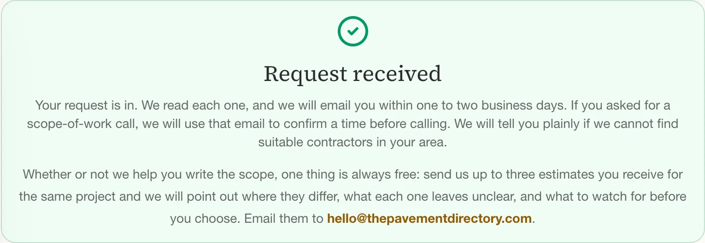
A green confirmation box means it was received.
Ready to try it?
The whole request is free, takes about ten minutes, and nothing goes to a contractor until we have read it.
Open the quote formUsing the outline on a phone
The outline works on a phone or tablet. Tap a corner to place a point. One finger scrolls the page and two fingers move or zoom the map, so you can scroll past the map without moving it by accident. The map also has a full-screen button in its corner, which gives you more room to place points.
Dragging a dot moves it, and Undo last point removes the most recent one. The estimated square footage updates under the map after every change, just as it does on a computer.
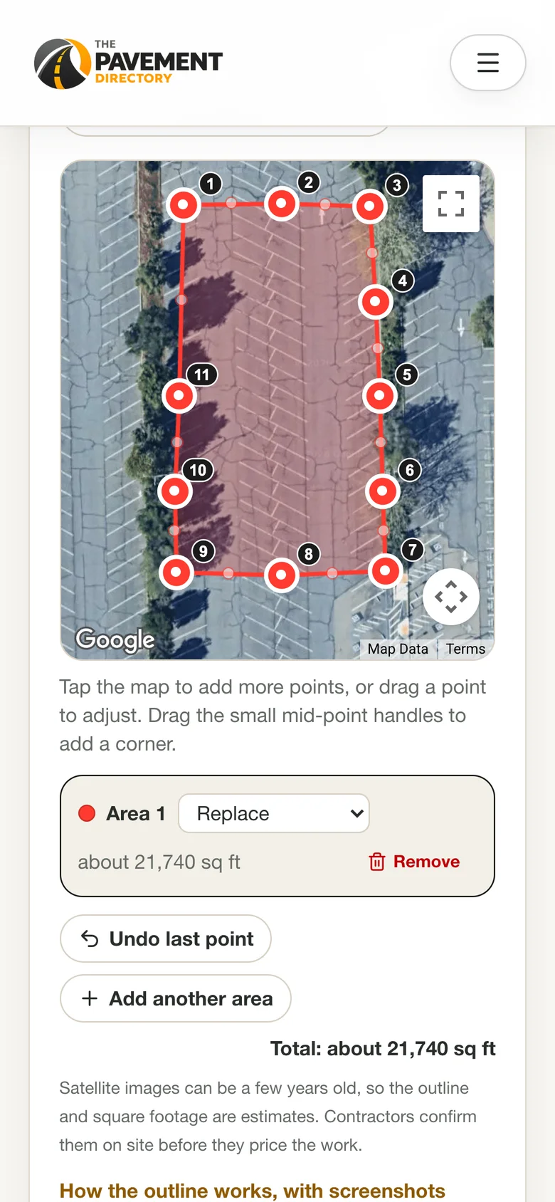
How accurate is the square footage?
The number is an estimate, and it is described that way everywhere it appears. Two things limit it: satellite photos can be a few years old, and a tap on a screen is off by a few feet at every corner. For a typical parking lot that is a small error, and it is far better than a guess.
The form works the number out from your points and we calculate it again on our side, so it matches what you saw. Contractors confirm the measurements on site before they price the work, and a drawing is never a survey. If the photo is out of date (a new building, a lot that has been resurfaced or reconfigured), say so in the notes.
The tool refuses an outline that crosses itself, because a bow-tie shape cannot be measured, one that is smaller than about 100 square feet, because that is a mis-tap, and one whose corners are far from the address. The message tells you which and how to fix it.
What happens after you send it
Nothing goes to a contractor until we have read your request. After that:
We review it
A person reads every request. If something is unclear, such as an address that does not match the map, we email you.
We introduce the project
We introduce your project to independent contractors who work in your area and do the type of work you described. We aim for at least three, but availability depends on your area, the type of work and the season. If there are not enough, we say so.
Contractors see the project, not just a paragraph
A contractor who takes up your project receives your details and photos, the picture of your outline, a satellite link to the site, and a Google Earth file of the area. Your contact details go only to the contractors we introduce the project to.
You compare the quotes
Quotes come back to you. Whether or not we helped write the scope, you can send us up to three estimates for the same project and we will point out where they differ, what each leaves unclear, and what to watch for before you choose. It is free, and the decision stays yours.
If something does not work
- The map will not open
- Wait a few minutes and try again. The map can only be opened a limited number of times in a short period, to keep it free for everyone. A browser extension that blocks scripts can also stop it. Either way you can skip it: send the request and we will measure from the address.
- It says it could not find the address
- Check the street number and spelling, and make sure the city and state are filled in above the map. Then press the button again. If it still will not find it, skip the map and describe where the work is in the notes.
- The map opened on the wrong building
- Correct the address fields and press Look the address up again. You can also drag the map to the right spot before you outline.
- Tapping the map does nothing
- Points are added to the area that is being edited, which is highlighted in the list under the map. If none is highlighted, press Edit on an area, or Add another area, and tap again. The shading appears once an area has three points.
- It will not accept my outline
- The message names the reason. The usual ones are lines that cross each other (move a dot so the edges do not cross), an area that is too small to be a project, or points that are far from the address.
- A photo will not add
- Use JPG, PNG, WebP or HEIC files under 15 MB, up to ten in all. On a slow connection give it a minute: each photo shows "Uploading..." until it has been added, and the Send button waits for them.
- I would rather not draw it
- That is fine. The outline is optional. Send the request with the address, photos and notes, and we will measure from the address.
Quote request and outline: common questions
Do I have to outline my property to get quotes?
No. The outline is optional. If you skip it, the street address, photos and notes are enough, and we measure from the address. The outline simply gives contractors a drawing and a starting number, which usually means firmer quotes.
How accurate is the square footage from the outline?
It is an estimate. Satellite photos can be a few years old and a tap on a screen is off by a few feet at each corner, so it will not match a survey. It is close enough to start a quote, and contractors confirm the measurements on site before they price the work.
Can I outline more than one area?
Yes, up to five areas on one request. Label each as Replace, Repair or patch, or Other work, and the form adds them up to a total. Each area can have up to 40 points.
Does it work on my phone?
Yes. Tap to place a point, use one finger to scroll the page and two fingers to move the map. The full-screen button in the corner of the map gives you more room.
Who sees my outline and photos?
We do, and the independent contractors we introduce your project to. Photos are stored privately and are not shown on the site. Your name, email, phone number and address go only to the contractors we introduce the project to.
Is the quote request really free?
Yes. Matching, the optional scope-of-work call and the review of the quotes you receive cost you nothing and carry no obligation to hire anyone. Contractors set their own prices, and The Pavement Directory does not perform the work.
What if the satellite photo is out of date?
Outline what the property looks like now as best you can, and say in the notes what has changed, such as a new building or a lot that has been repaved. Photos of the current condition are the best way to show it.
An estimate, not a survey: The outline and its square footage are estimates drawn from satellite imagery that may be several years old, and they are not a survey or an engineering measurement. Contractors confirm measurements and conditions on site and set their own prices. The Pavement Directory is not a paving contractor and does not perform the work.